Dual Antenna Mems Gnss/Ins Integrated Navigation System for Plant Protection Drone Low Power IP68 China Factory

Customization: Available
Accuracy: <1mm
Horizontal Line: 1

Product Description

Basic Information
Model NO.
I3700
Vertical Lines
1
Package
Box and Sponge
Specification
33*27*8mm
HS Code
9031809090
Capacity
1000/Month
Product Introduction

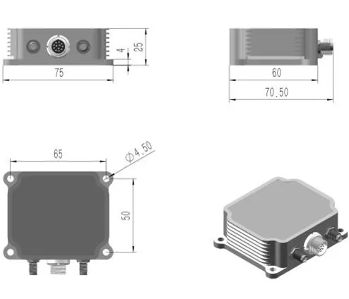
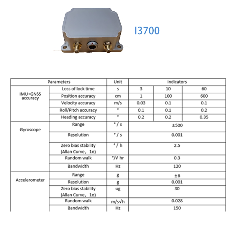
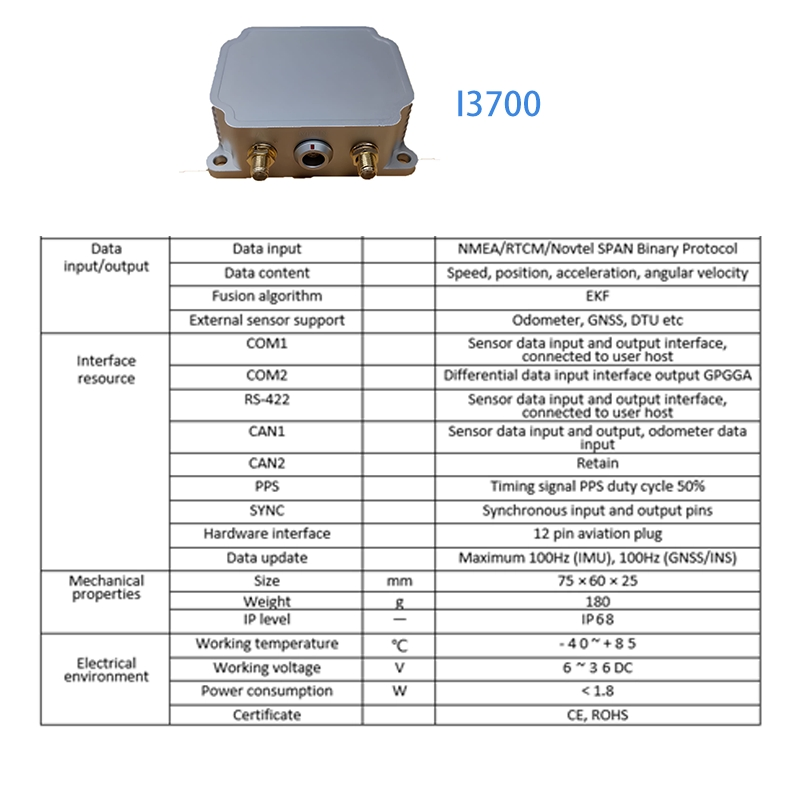
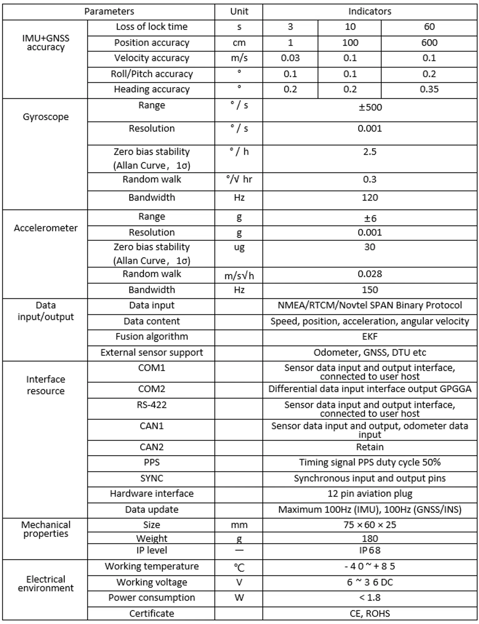
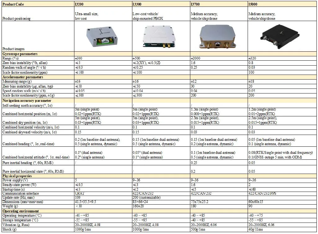
Integrated Navigation System: I3700

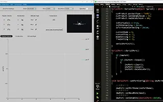
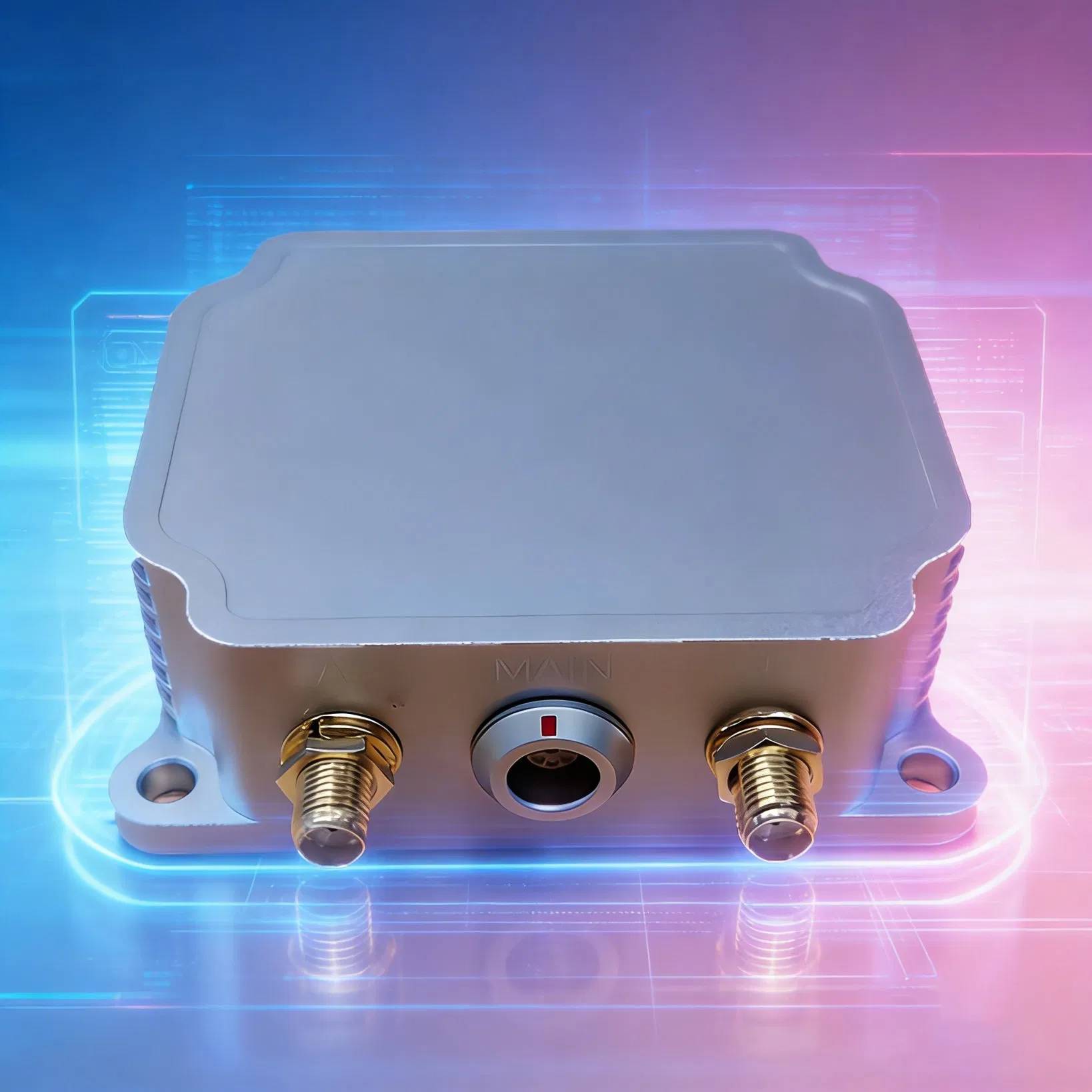
The I3700 is an integrated navigation system (GNSS/INS) composed of high-performance MEMS sensors, high-precision GNSS systems, and high-performance microprocessors. The built-in self-developed high-reliability integrated navigation algorithm can output the speed, position, attitude, and other information of the measured carrier in real time. Users can also externally connect RTCM differential correction data to achieve high-precision RTK positioning. The IP68 waterproof shell-type package can be easily integrated into the user's system.

Navigation System Specification
Product Features
Manufacturing System
• Automated batch calibration and testing production lines.
• Small size, embedded design, high compatibility.
• Factory calibrated zero offset and scale factors.
Software Algorithms
• Leading integrated navigation algorithm (Odometer/DVL support).
• High-precision positioning via CORS stations.
• Extended Kalman fusion for occlusion environments.
High Performance Sensors
• Gyroscope bias stability: 2.5°/h.
• Accelerometer bias stability: 30ug.
• Full constellation, full frequency RTK-GNSS system.
More Similar Products
Product View 1
Product View 2
Dimensions & Performance

Our inertial sensors are known for high precision, long life, and reliability, widely used in aerospace, automobiles, and robotics. Each sensor undergoes strict production and factory inspection processes to ensure industry-standard compliance.

Workshop 1
Workshop 2
Workshop 3
Dimensions
Frequently Asked Questions
Q1: What is the I3700 Dual Antenna GNSS+INS Navigation System?
A: The I3700 is a high-performance integrated navigation system combining dual-antenna RTK GNSS and MEMS inertial sensors. It provides real-time position, velocity, attitude, and heading information.
Q2: What is the positioning accuracy of the I3700?
A: It features RTK positioning: Horizontal 0.8 cm + 1ppm, Vertical 1.5 cm + 1ppm. The dual antenna configuration provides a heading accuracy of 0.2° per 1m baseline.
Q3: What are the main application scenarios?
A: It is widely used for UAV/Drone navigation, driverless vehicles, robot navigation, smart agriculture machinery, and unmanned vessels (ROV).
Q4: What is the ingress protection (IP) rating for this system?
A: The I3700 comes with an IP68 waterproof shell-type package, making it highly resistant to dust and water immersion.
Q5: How does the system perform when GNSS signals are occluded?
A: Based on the extended Kalman fusion algorithm, the system can still provide continuous and reliable navigation information even in signal-occluded environments.
Q6: Does it support external differential data?
A: Yes, users can externally connect RTCM differential correction data to achieve centimeter-level high-precision RTK positioning.

Related Products